Your role is to find the right site, for the right client, at the right time. It's not to reverse-engineer municipal portals, reconcile zoning bylaws, or spend time parsing through fragmented sources.
Raeo standardizes disconnected geospatial data, so brokers can spend time on what matters most: building high-value client relationships that last.
The Raeo Difference
Turn Development Projects Into Qualified Site Shortlists.
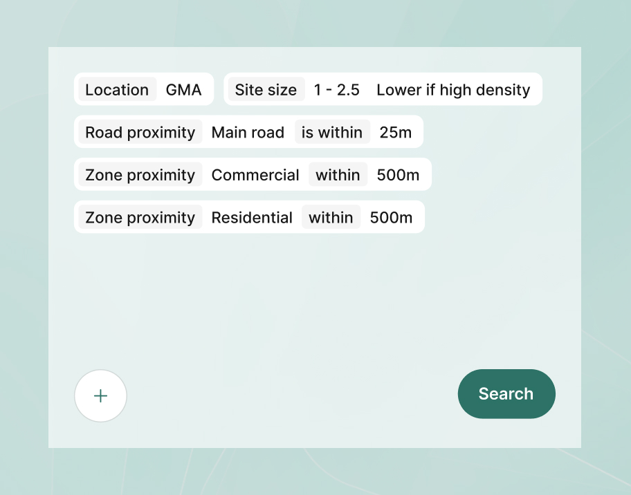
Define Project Specs
Tell us what land project you're looking to build. Asset class, size, proximities and more. Set your priorities and let the platform know what matters.
Check Sites At Scale
Raeo scans millions of land parcels at a time, cross-referencing zoning records, assessment data, and environmental constraints. We even provide access to the raw data for quick verification.
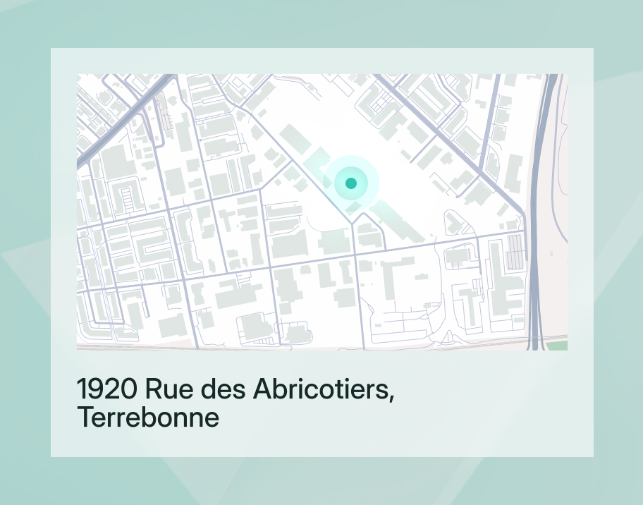
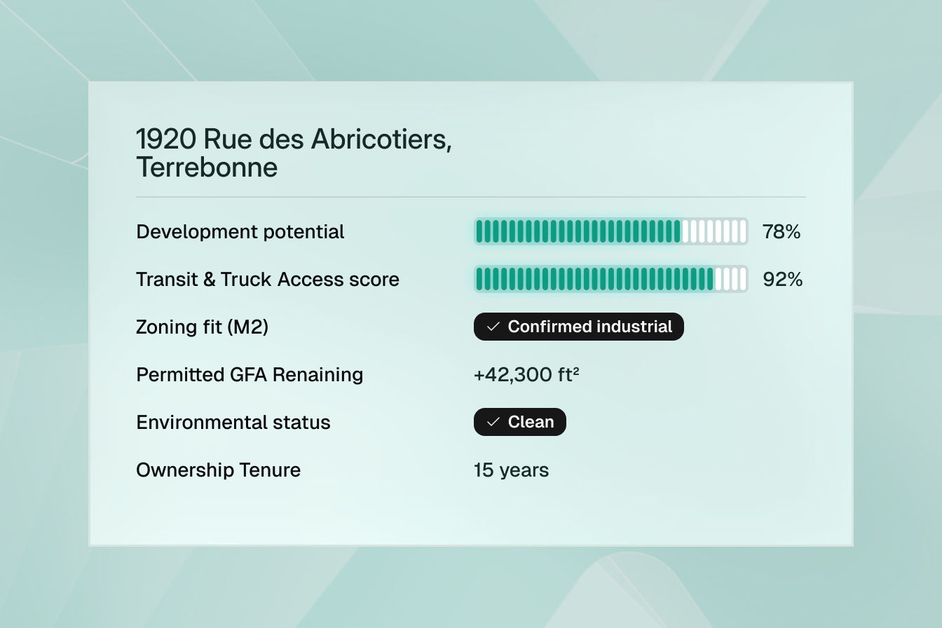
Close Deals Faster
The result is a ranked list of qualifying sites, scored by your weighted criteria and ready for action. Compare them to each other, explore our interactive map, and export client-ready reports.
The Evolution of Land Discovery.
A New Kind of Mandate Workflow
Traditional tools show you what's listed. We show you what's possible. Raeo combines 4.5 million parcels of raw municipal data with intelligent scoring to reveal the gap between what a site is today and what it's permitted to become. That's the difference between searching listings and discovering opportunities.
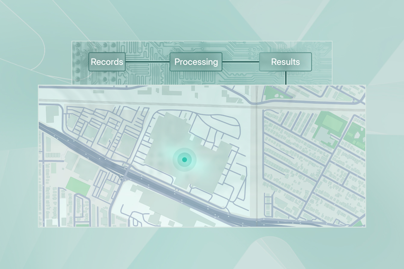
Built on a Proprietary Data Engine
We don't rely on third-party data feeds or listing platforms. Our system processes raw municipal records directly from source: cadastral files, zoning bylaws, assessment rolls, permitted use tables... normalizing and cross-referencing them into a single queryable dataset. Millions of parcels, all searchable and ready for project deployment.
frequently asked questions
Teams are Asking
Clear answers, no fluff. We’ve designed Prospect to feel intuitive from day one—but here’s where we answer the most common questions with clarity and care.
How is this different from existing site selection tools?
Listing platforms focus on the parcel, not the project. GIS tools require technical expertise and manual data assembly. Municipal portals give you raw data one parcel at a time. Raeo unifies all of it — zoning, assessment, permitted uses, infrastructure, environmental constraints — into a single search that scores and ranks every qualifying site in seconds.
Where does the data come from?
Directly from municipal sources. We process raw cadastral files, zoning bylaws, assessment rolls, and permitted use tables ourselves — no third-party data vendors, no per-lookup fees. That gives us full provincial coverage and complete control over accuracy and freshness.
What types of projects does this work for?
Any commercial or industrial site search. Industrial, logistics, self-storage, multifamily, retail, mixed-use — if it involves finding land that meets specific zoning requirements, size constraints, and infrastructure needs, Raeo handles it.
Does this replace the broker?
No. It replaces the hours brokers spend on manual research so they can focus on what actually closes deals — client relationships, negotiation, and advisory work. Raeo makes brokers faster, not redundant.
Is this only available in Quebec?
We're launching with full Quebec coverage — 4.5 million parcels. National expansion is on the roadmap, and Quebec's data complexity is actually the hardest market to build for. Other provinces will be faster to onboard.
How fast are the results?
Sub-second. Define your requirements, hit search, and get a ranked shortlist immediately. The same process that takes analysts days or weeks of manual portal research happens in the time it takes to load a page.
Can I use this in front of clients?
Yes. The platform includes a presentation mode built for live meetings — simplified visuals, real-time filter toggling, and side-by-side parcel comparison. You can also export client-ready PDF reports with map snapshots and full parcel details.